
This morning being bright and crisp was obviously custom made for yet another hike. In the past week I'd gone on 6, 8.5, and 10 mile hikes, so today's hike would have to also be an incremental step up.
Having tackled Lair O' The Bear before, I knew it would add a couple more miles, but without crippling me in the process.
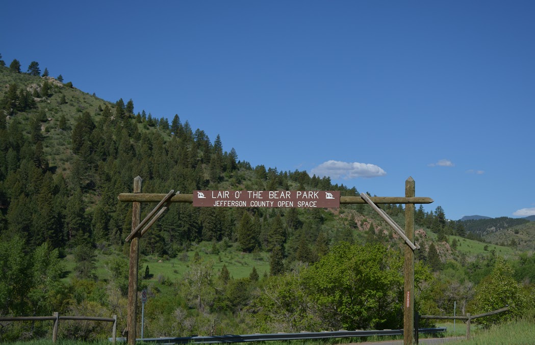
Lair O' The Bear Park is located approximately 10 miles from
Lakewood. As you drive west on Colorado State Highway 74 it's on your left just before the small town of Kittridge.

Lair O' The Bear provides mostly flat, well-shaded hiking trails that skirt and cross Bear Creek. It is a very easy-breezy place to hike. However, it does lead to a much more challenging hike, the Bear Creek Trail, which is a ten mile round trip from where it begins in Lair O' The Bear Park to a point 5 miles out where the trail ends at Pence Park along Myers Gulch road, and then 5 miles back.

Lair O' The Bear is a very popular place. I hadn't hiked here in 6 or 7 years, and had completely forgotten how popular it was. I arrived fairly early in the morning, and the parking lot was already half-full.
Just beyond the parking lot a group of photographers, set decorators and models were putting together a set for a Coleman Tent advertisement. Not very nature-loving, but a pretty good testament to the beauty of the area.

To get to the more challenging trail it is necessary to walk about a mile and a half on a trail that borders not only Bear Creek, but also Highway 74. Traffic can be loud, but it's easy to tune out.

Bear Creek is raging full on right now, a result of all the late Spring snow and the recent heavy rains Colorado has seen. There are fish in the creek, and of course that means there will be fishermen. No fishermen were to be seen today, but sure as sunshine there will be a few eventually. Fly fishing is big in Colorado.

One of the more interesting sights in Lair O' The Bear Park is Dunofon Castle. Originally constructed in 1941 by Marcus Wright, it went into a trust after his death and for a number of years that trust somehow managed to abuse the place, renting it out at times as a casino and even as a house of ill repute.
The property eventually fell into unusable disrepair and sat vacant for a long while until it was purchased in 1970 by the Barnes family. They completely restored, updated, and renovated the property.
After the tragic deaths of Mr. and Mrs Barnes (along with a daughter) in an aircraft crash in 1999, the property once again fell victim to neglect. It sat empty and decaying for 5 years until it was purchased by Michael Dunafon and Debbie Matthews, who hired the residents of a local alcohol rehabilitation program to help them bring it back to better than original condition.
It's available to rent for events. Looks like a fun place to party.
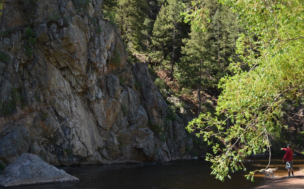
The park is a very family friendly place, and pet friendly too. County leash laws still apply, but no one seemed too concerned about them and let the dogs enjoy a little freedom.

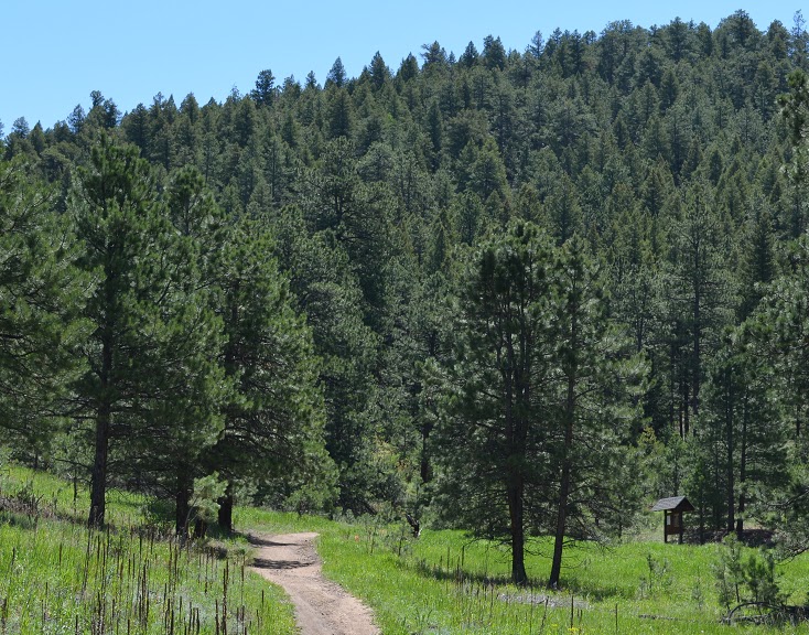
The beginning of the more challenging Bear Creek Trail
The onset of the Bear Creek Trail is a little more than a mile of steadily walking uphill. There are numerous switchbacks, and the trail is fairly wide, so it's not too difficult. It's just, you know...uphill.

If you are able to hike the trail on a clear, sunny day, the views will impress. Eventually you will reach an elevation in excess of 7,400 feet, and see a great panorama of the Rockies.

Speaking of the Rockies, the trail does give constant reminders of why the range was named the Rockies...there are Boulders and Monoliths everywhere along the trail, though most have been cleared away sufficiently so as to not interfere with the path.

Remarkably enough, the hike up the first mile of the trail, though strenuous, is not that tough. That's due to the numerous switchbacks and short level sections of the path that allow you to regain your strength.

As I walked further up the trail, traffic thinned. There were still a lot of

Yesterday it was raining up here for nearly the entire day. The trail was still muddy in some places, but not to the point of being a hindrance. Heavy clouds dotted the western horizon, but they kept their distance and there never was much of a threat of rain.

By the time I had passed mileage marker 2.0, the trail started a steady descent towards Pence Park. The

Warning signs about coyotes, snakes, or even bears are not present on the trail, but assume that, since it is the wild, there is going to be wildlife. The little guy above was all I saw today though.

It was terrific how green the mountains were now. A decade ago a Pine Mountain Beetle infestation was leaving mountainsides dotted with dying (and brown) spruce and pine. An effective eradication program was implemented and the results are fantastic.

There were still a few trees that showed signs of the infestation, but they were far and few between.
At this point on the trail the hike had taken a little more than an hour and a half. The hike wasn't too taxing, and stopping to take pics afforded me a lot of rest periods.

There were a number of occasions along the path when it appears the end of the trail has been reached, only to find that it was just a sign giving mileage traveled so far or options for diveregent trails, This one showed that there was just a bit over a mile left of the hike.

The beauty of Colorado is remarkable. I hope to continue these little day hikes as long as weather and my work schedule permits. It would be almost criminal not too.

There are people who have been fortunate enough to acquire property along the perimeter of the park and have built houses that allow them to enjoy the beauty of Colorado everyday. Those people are to be envied something fierce.

Check that. Envy those people a little bit - Envy the supervillain who built this mountaintop lair a whole helluva lot more.
It's always the supervillains who get the cool pads.

Finally, after a little more than two hours of hiking, once again the sound of road traffic could be heard and that meant the end of the trail had to be close. Whoo-Hoo! (All the best hikers say "Whoo-Hoo" upon reaching the end of a trail).

Seeing the last bit of trail taper towards Myers Gulch Road almost felt like a victory. Or rather, an accomplishment. Sure, a small accomplishment, but these days you gotta take what you can get.

A little over 6 miles from the Lair O' The Bear parking lot to the end of the Bear Creek Trail at Myers Gulch Road. Now all that's left to do is retrace my steps a little over 6 miles back to the truck...

No comments:
Post a Comment