
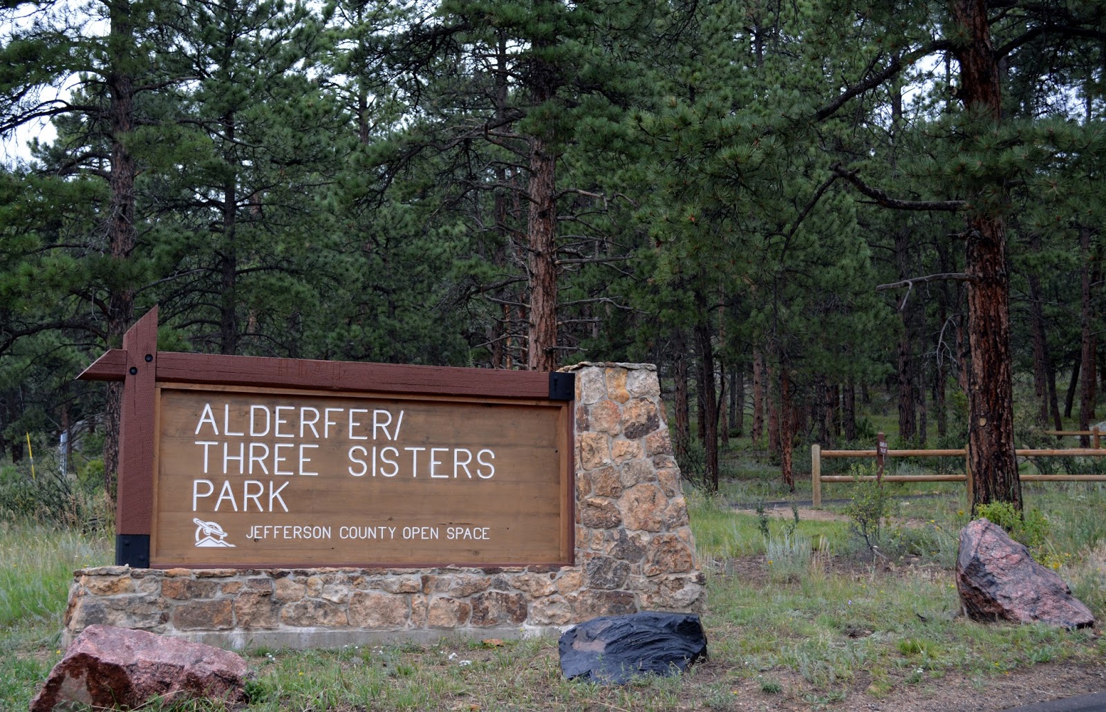
Just north of C-470 up Colorado Highway 74, and a little ways along Colorado Highway 73 to Buffalo Park Road, is a pleasant little park that boast 13.9 miles of hiking/jogging/mountain biking trails with a few unique geological features, historical homesteads, and quite a bit of Colorado flora and fauna thrown in to make the visit an interesting adventure.
The drive from my home in Lakewood was approximately 3/4's of an hour, and that includes stoplights and slow traffic. It's a beautiful drive up 74 through Morrison, Idledale, and Kittridge btw, especially in the morning when the sun is pouring into the canyon.

The Hidden Fawn trail is basically a dirt sidewalk
Alderfer/Three Sisters is Jefferson County Open Space, and was acquired through donations of land from the Alderfer family and the Spencer Wyatt family, as well as purchases made from the aforementioned, from 1977 through 1986. Additional acreage was purchased from the State Land Board in 2002.
The park is just under 800 acres, and while it is known primarily for the Three Sisters and The Brother rock formations, it also has a trail that winds it's way up to the 8,536 foot summit of Evergreen Mountain.
Midsummer means almost daily rain in the mountains and foothills around Denver, so it is wise to bring along a jacket or poncho in case the clouds decide to burst as you hike. While this park is not as isolated or as wild as a lot of the parks in Colorado are, the elements are still a factor and should never be ignored.

The Three Sisters are on somewhat of a northern slope and as such it can get a little chilly, even in the afternoon of a warm sunny day. Fortunately, I prepared well in advance by developing several layers of subcutaneous fat to keep me warm, all polar bear like.

Walking along the Hidden Fawn Trail and staring off into the forest it eventually becomes apparent how the trail got it's name - there are a lot of deer hidden in there. The deer are docile, almost tame, which comes I suppose from not having to deal with the treat of hunters in the little sanctuary.

The rains not only bring out the wildflowers, but a wide variety of fungus as well. The mushrooms grow fairly large and colorful, which may or may not be a good thing. Magic or not, mushrooms have very limited appeal to me.

Cairn building is becoming a thing in Colorado. In the past two months, and over a few hundred miles of trail, I must have passed a few hundred of these, some are very simple little stacks of flat rocks, and some are very involved structures that look like small Japanese temples.

The trail makes it's way past, over, and through a lot of rock formations, most of which have been well-worn by millions of years of exposure to the elements. The Rocky Mountains offer an excellent shortcourse in geology.

Once off the Hidden Fawn Trail and on The Sisters Trail it is only 15 minutes to the Three Sisters and The Brother. The trail is a fairly easy switchback with only a 250 or so foot elevation gain from the parking lot.

At the base of Three Sisters the temptation to clamber over the rocks is nearly overwhelming. It's as if there is some innate desire to see the view from the top. Fortunately, finding a route up is easy, and hand/foot holds are very evident (and stable).
Scrambling up any of the Three Sisters or The Brother is not too difficult (no gear is allowed, so it's all hands and feet). I made it up The Brother to get a photo of the Three Sisters in about 15 minutes, and trust me you, I am no rock climber.

The views are excellent, though there are a few larger trees that poke up and obstruct here and there.

I opted to follow the Bearberry Trail once I left the Three Sisters. The path is wide and an easy walk down to where it meets up with the Mountain Muhly Trail.

The Mountain Muhly Trail, as the name implies, winds around Muhly Mountain. At 7600 feet, it's more of a hill by Rocky Mountain standards than a mountain, but it does meander past an interesting old barn and adjacent cabin (now boarded up tight), and there is plenty of beautiful scenery to take in.

There is no signage other than "Keep Out" posted on or near any of the buildings that are along the Mountain Muhly Trail. The large cabin that is just past the barn looks at least 60 or 70 years old, with electrical service apparently added sometime after the cabin was built. It's a great old structure, and if it starts raining there is plenty of room under two separate porches to find shelter.

The trail continues beyond the old cabin as a narrower, single track, though one that is still relatively easy to hike. The path quickly tops the mountain and the descent is along the west slope.

The trail down has seen a bit of rain recently
From where the Bearberry Trail met the Mountain Muhly Trail to the top of the mountain took thirty minutes, and that includes time spent exploring the area around the old cabin. This hike, while at a slightly higher altitude than Lair O' The Bear and Pence Park, was proving to be far easier than that much shorter hike.

View of the Three Sisters (and brother) from Mt.Muhly Trail
Muhly is somewhat northwest of the Three Sisters, and offers a nice view of the formations on the other side of the valley as you hike along the trail.

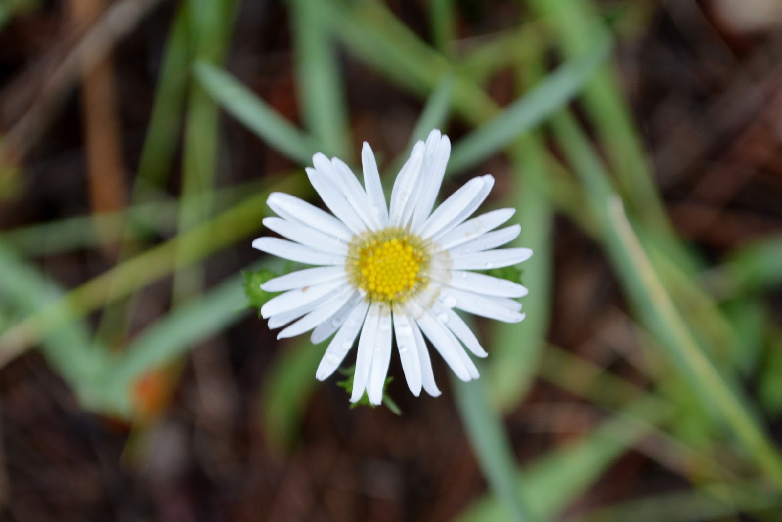
The midsummer rains have brought out the wildflowers

The forest the trail cuts through is full of the sounds made by wildlife - chattering squirrels and chirping, cawing birds. Every so often the rustle of branches can be heard as well, the sound of the large mule deer making their way through the trees.
Mule deer sightings are common, and are generally a good thing, as it indicates that mountain lions and bears are probably not around.

The Mountain Muhly Trail was at one time a service road (for access to the old cabin, I imagine) and is still well maintained. Hiking along this trail, even at altitude, is as easy as walking along the sidewalk in front of my house.

The Alderfer homestead was originally settled in the mid-1890's by George Dollison, and became the home of E.J. and Arleta Alderfer on Christmas Eve of 1945. The Alderfer family lived and worked on the property, expanding it to include a working cattle ranch, until the mid-seventies when Jefferson County Open Space began acquiring the property.


The best view of the Three Sisters and The Brother are from the Silver Fox Trail where it meets the Ponderosa Trail. The trail junction is only 1000 feet of level, well groomed trail from the Le Masters Road parking lot near the Alderfer homestead.
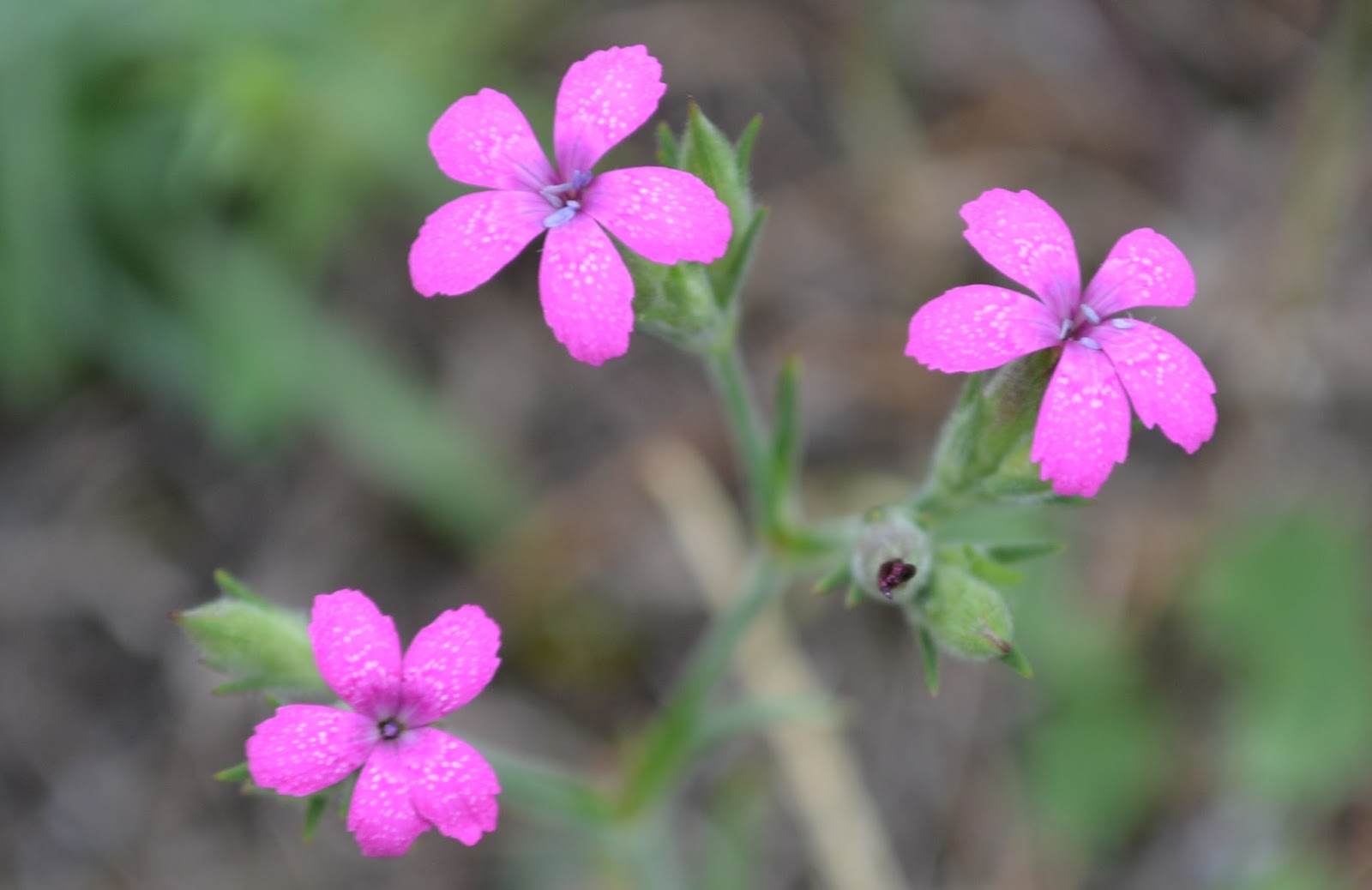
The color variations in the wildflowers are incredible
This particular portion of the trail features views of wildflower-covered mountain meadows, and there are even a number of benches available for anyone who desires to sit awhile and enjoy the cool mountain air.

The Mountain Muhly Trail eventually meets the Bluebird Meadow Trail, which leads to the Alderfer homestead and ranch along Buffalo Park Road next to the Le Masters Road parking lot.
There is a large herd of deer that makes it's home in the park, and in the area in front of the Alderfer homestead.
They are mule deer that have been adopted by the people of Evergreen, and have become almost tame.

The deer gangs of Evergreen
Crossing Buffalo Park Road to the south section of the park the first trail encountered is a nearly level half-mile trail named Wild Iris Loop. It encircles a meadow that is generally filled with wild irises and other wildflowers, hence the clever name.
At nearly the southern apex of this trail is the junction with the Evergreen Mountain West Trail, which leads to the summit of Evergreen Mountain.

The Evergreen Mountain West Trail
The trail is not too steep, but it is an ascent. The elevation gain is about 600 feet, and the trail is very popular with lunatics Mountain Bikers. It being a single track trail though I had to quickly step to the side to allow a careening Biker to blaze on past on a couple of occassions.

Hiking along the Evergreen Mountain West Trail the evidence of a Forest Management Project can be seen strewn all over the mountain. There is a large sign along the trail that explains that the Lodgepole Pine Forest has been thinned to increase habitat and vegetation diversity and to reduce the wildfire hazard.
What I don't understand though is, if the intent was to lesson the danger of a wildfire, why leave all the very dry, very flammable dead trees scattered throughout the forest? I mean, isn't that just a loose stack of firewood?

The view from the summit of Evergreen Mountain, while not quite what it was from last week's trek up Mount Bierstadt, is still pretty impressive. The front range of the Rockies sprawls out for hundreds of miles, and the small city of Evergreen looks like a child's playset left out in the backyard.


The crest of Evergreen Mountain is still below the tree line, but being as how the mountain is composed primarily of granite, the trees have to work to find soil. It amazes and impresses me to see trees growing straight through solid rock.

Being exposed to the elements at the top of a mountain also means the trees are under constant assault by those same elements. The wind and the rain combine to contort the trees as they grow, and everywhere toppled trees that look like rung out dish towels are scattered on the ground.

This little dude was quick!
There are plenty of squirrels running around at or near the summit of Evergreen Mountain, but those guys must be the preferred food source for a number of predators, as I have never seen such speedy little critters. They have developed serious scurrying skills.

The area surrounding Evergreen Mountain features many natural and manmade meadows. The manmade meadows are the result of pastures created for the grazing of cattle and horses. There are still working ranches in the area, though not too many run cattle - mostly just recreational horse boarding nowadays.

The Evergreen Mountain East Trail makes it's way down the peak with a few switchbacks and a number of long sections of wide path that pass strands of Quaking Aspen and thinned out Lodgepole Pine forest. From the short Summit Trail to the parking lot is close to two miles, but it's as gentle a downhill two miles as one could hope for.

The last few hundred yards of the park
All told, the hike was not too difficult - pretty easy on the feet and legs, and not too challenging in terms of an increase in altitude (from my home in Lakewood to the summit of Evergreen Mountain is a little over 3,000 feet).
Of the 13.9 miles of trails available, I hiked 10.7, but I think being at less than 9'000 feet and not having too much in the way of steep ascents to deal with made that the easiest 10.7 miles I've hiked in a long while.
This is a park that has something to offer just about everyone. However, if hiking up and down even well-maintained switchbacks is not your thing, drive on up to the old Alderfer home and check out the deer herd that makes it's home there. Very photogenic, that group.
No comments:
Post a Comment