

Green Mountain is not all that imposing from the Alameda approach
This morning was quite the dramatic contrast to yesterday's day-long torrential downpour. Birds were chirping, cats were licking their chops, the hills were alive with the sound of...a really violent wind.
But that's neither here nor there. What's here is the bright blue skies and blazing sun that made this morning perfect for a hike up and around Green Mountain, the first nature hike of the season for the most part.

Welcome to William Frederick Hayden Park At Green Mountain
Green Mountain is about 3 miles to the west of my home. It does not appear to be much of a challenge as far as hikes go, and truth be told, it's not. Oh sure, the elevation will probably put some hikers out, especially those from close to sea level, but that could be said of most hikes in Colorado.
There is about a 2,000 foot increase in elevation from my home to the top of Green Mountain, which is just enough to make the hike interesting without regret.
The hiking trails along Green Mountain are in a park named after William Frederick Hayden, whose family donated or sold the majority of the land used for the park to the city of Lakewood.

Pick a trail and enjoy!
I took the Green Mountain trail today, as I was feeling chock full of vim and vigor.

After the first couple hundred yards, a bench is provided to rest on
The park covers about 4 square miles, and offers amazing views of Denver and the surrounding area. It's as hospitable as a park can get, with well-maintained trails and even several areas to rest along the way.

A half mile up and the view is incredible
The hiking trails are a great combination of climbs and descents, almost rollercoaster-like in their undulations. It is about as easy a 2,000 foot climb as I've ever made.

Hey! I can see my house from here! And everything else to the east
The first mile of trail gets you about 1,000 feet up. From there the grid layout of the streets of Lakewood and the surrounding area begins to look like a model train set.

The trail up to the deceptive first tower hill...not quite the top
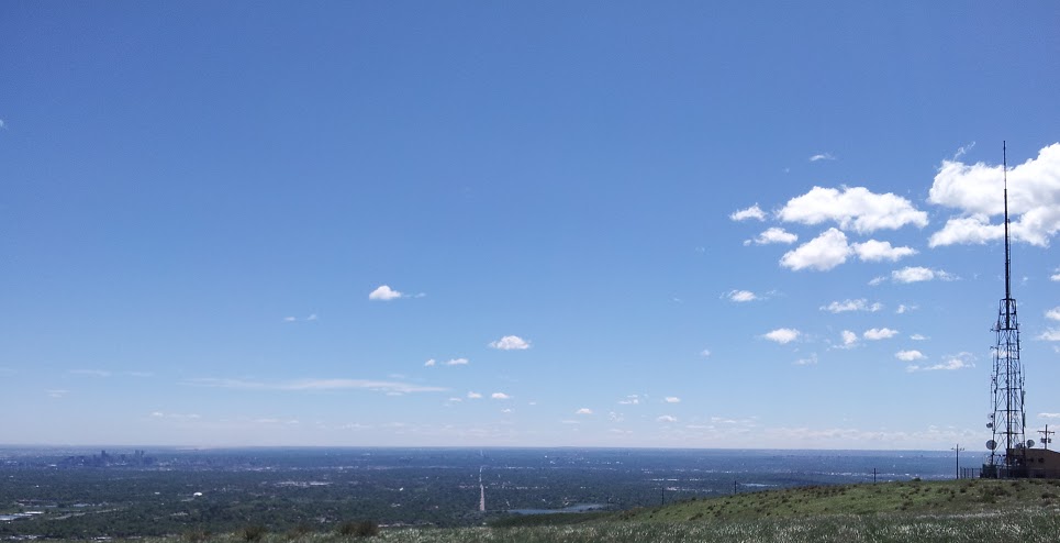
First time hikers can be fooled into thinking that the summit is within easy reach when the radio antenna is in sight. That is a common misconception. The angle of view hides the three hundred or so yards beyond the tower where the actual crest of the mountain is.

Love declared near the top
At the tower, evidence of the easier west face approach abounds. The west approach follows the radio tower service road - beaten paths don't get much more beaten than that, Mr. Whitman.

Two joggers...I mean lunatics
The service road section of the Green Mountain trail is like a domesticated cat. it's easy to be fooled into thinking it's an approachable, docile creature.
View to the east from the top of Green Mountain
The view from the area near the top of the mountain is incredible in all directions. You'll want to spend a few minutes drinking it in - and some water, if you brought it.

View to the north - Golden, Arvada, Westminster...if you squint, Broomfield
There are many small trails that lead away from the area near the top of Green Mountain. They look like game trails, but they are actually trails made by that special brand of lunatic known as mountain bikers.

View to the southwest - Red Rocks park is right above Dinosaur Ridge
Once you have taken in the spectacular views from near the summit of Green Mountain, you're ready to actually crest the summit, a mere...several hundred yards away.

The last few hundred feet up
Just put one foot in front of the other...it's worth it, trust me.

The Cairn at the top
Finally! You're at the top, the very top! Look at that view! Look at all that...indistinct stuff.

Growing at 6,000 plus feet
Once you've crested the mountain top, it's time to head on down. The Green Mountain trail follows the service road down to the Rooney Valley parking lot on the southwest side of C-470...or you can take the Rooney Valley trail, which is much more scenic.

The Green Mountain Trail follows the service road down on the west side
With the 60 mph wind gusts at your back, going down is much more pleasant than going up.

The Rooney Valley
The Rooney Valley trail skirts Green Mountain from near the summit until it parallels Alameda Parkway from just north of the bridge over C-470, and then back to the parking lot.

Just in case, you know, you hauled the thing up the mountain...and a machete
Green Mountain is more than just a recreation area for hikers, joggers, and mountain bikers. Feel free to bring your paraglider up for an afternoon of fun.

Come to think of it, Green Mountain isn't much of a clever name
Once you're down in the Rooney Valley it becomes readily apparent why the name Green Mountain was chosen over, say, Mordor.

Yellow daisies dot Green Mountain
The flora and fauna of Green Mountain is varied. There is much to appreciate, but there is also quite a bit to be careful of. Coyotes and rattlesnakes inhabit the area, as well as some man-made menaces.
As one of the signs below points out, if you see something that looks like it may have been used by the military, there is the chance it was - leave it alone.


Sign, sign, everywhere a sign...
The park is very well-maintained, by Jefferson County staff and by volunteers. A tip of the hat and mucho thanks to all of them!

This sign reflects yesterdays torrential rain
As Green Mountain does not have dense vegetation that inhibits the flow of water, specifically rain, the storms that hit the area frequently result in muddy, muddy trails. be careful!

This sign got the memo updating conditions
Today, after just a few hours of sun, all the trails were pretty dry and accessible. It as a truly great day for a hike and if you have the time and inclination on a similar day, I can't recommend it strongly enough!
No comments:
Post a Comment